Showing posts with label North Berwick. Show all posts

Sunday, 2 February 2014

Prehistoric burials of the East Lothian coast

Prehistoric Burials
Scotland’s prehistory stretched for some 9500 years from the earliest settlers to around AD 1000. There was some written history during the last thousand years of that period, but so little that it was effectively still a prehistoric era, and we rely upon archaeology to provide details of how people treated their dead. I should note at this point that these are not the normal everyday people but people whose remains for some reason were treated in an exceptional way; in a way that provides us archaeological evidence. The majority of the people are not archaeologically visible. Their remains used in a way that rendered their decomposition complete. We will only be concerned here with the sites that have left physical evidence.
So let us now go in search of what remains of the prehistoric burials of the coast of East Lothian.
Barrows: Ancient burial mounds.
The earliest formal burials in Scotland that we know about, and which involved any kind of grave structure, took place after about 4000 BC. These took the form of a chambered tomb which were often constructed form large stones or as was the case in lowland Scotland, timber, turf and earthi. Into these tombs would be placed the decomposed and disarticulated remains of the deceased. The chambered tomb was then covered with a mound of earth or a stone cairn. The later mounds were often round in shape but the earliest were long and rectangular. Evidence for such long barrows in our area of interest can be found (Table 1) near Luffness Mains (NE47 NE5) (illustration 1)and Aberlady (NT47 NE1).


RCAHMS SITE NUMBER LOCATION OF FIND SITE TYPE
NT47NW 1 Aberlady Parish  BARROW(S), CIST, LONG CIST(S) 
NT47NE 1 Aberlady, St Mary's Chapel  BURIAL GROUND, CHAPEL, CIST(S), CROSS SLAB 
NT48SE 1.01 Luffness House  CIST(S) 
NT48SE 4 Luffness House  CIST 
NT48NE 1 Gullane Links  CAIRN(S) 
NT48SE 21 Gullane Sands  CINERARY URN, MOULD (CLAY)
NT48NE 6 Gullane Links  LONG CIST
NT48SE 19 Gullane Golf Course  LONG CIST(S) 
NT48SE 24 Gala Law  CINERARY URN
NT48SE 53 Gala Law  BURIAL 
NT48SE 5 Kilspindie Golf Course  CIST(S) 
NT47NW 7 Longniddry Golf Course  CIST(S), BEAKER, CINERARY URN(S) 
NT48SE 14 Park Hills (West Fenton) CIST 
NT58NW 6 West Links (not far from the Eel Burn) CIST(S), CINERARY URN(S) 
NT77NW 16 Broxmouth (Dunbar) BURIAL(S), CIST(S)

Table 1: Prehistoric burials of the East Lothian coast


Illustration 1: Luffness Mains: RCAHMS Aerial Photography Digital Oblique aerial view of the cropmarks of the settlement and barrows, taken from the E. DP070181 Copyright RCAHMSImage


However, these sites have not been explored in any detail. For a well excavated site we have to go to Eweford near Dunbar, which was thoroughly excavated and revealed evidence of burial practice relating to this time period. Archaeological excavations were carried out between 2001 and 2004, in preparation for the upgrading of the A1 to dual carriageway between Haddington and Dunbar. At Eweford they found evidence that suggested people started to bring human remains to the site about six thousand years ago. Here they built and rebuilt a large mound and capped it with a stone cairn. Their funereal practices also involved the construction of a timber enclosure and successive mortuary structures; mortuary enclosures are considered to have been used for the exposure of human remains prior to secondary burial. These wooden constructions were eventually destroyed by fireii.
The long barrows are also considered to have had some sort of territorial symbolism; perhaps signifying that the area adjacent to the barrow is owned by the group whose ancestors are entombed insideiii. The burial mounds are very prone to erosion by the elements and stone cairns have often vanished due to the stone being robbed out for another purpose. The mounds that were in the fertile land of East Lothian are vulnerable to damage by ploughing; often it is just aerial photography that reveals where they once were.
On the other hand, the act of ploughing has revealed to us hidden graves, especially the stone lined box grave we know as a 'cist' and it is to this form of burial that we now turn.

Cists
The cist burial can be separated into two distinct types: the short cist and the long cist. The one main thing that they have in common is that they are basically a hole lined with stone slabs, into which was put human remains and sometimes artefacts. The trend towards placing remains in cists started in the late third millennium BC. The earliest form was the short cist, which was used for the burial of single, multiple, articulated, cremated and mixed cremated remainsiv. The Bronze Age short cist does not tend to have grave-goodsv but some have been found to contain cinerary urns (for it was at this time that the use of cinerary urns was being adopted in Scotlandvi) into which the cremated remains would be placed and then inhumed in the cist. Usually only the remains of one person would be placed in the urn but sometimes there would be two or more. However, at one site near Dunbar the remains of at least 21 individuals were found in one massive cist that dates to the Iron Agevii. What is not known is whether these people died at the same time or were they kept aside until a specific person died and their remains would join the first?
The next phase of cist burial was the long cist. This was as the name suggests, a full length stone lined burial. These graves appear more frequently in the archaeological record from the first few centuries AD onwardsviii.
Cist burials are the most numerous of prehistoric burial types that are found in the Luffness and surrounding area and we should now take a look at the cist burials that have been recorded.

Coastal Cists
We can see from the excavations and finds that have been recorded that the coastal plain of East Lothian has numerous prehistoric inhumations of the short cist type. All along the coast from Dunbar to Longniddry, on the elevated spots of Kingston common (NT58SW 152) and around North Berwick Law (NT58SE 13) can be found short cist burials. In fact the site at Kingston has evidence of burials spanning the Neolithic to the early second millennium ADix.
If we move down the coast a little from North Berwick onto the West Links,there is an area near the Eel Burn (NT58NW 6) where Bronze Age cists were found. A total of twenty three cists, three of which had urns. Human bones without cists were also found at the burn side.
There is no evidence of burials from the Eel Burn to Marine Villa but a little further along the coast there is another site that was popular for cist burials in the Iron Age (NT48NE 1). The site was visited in 1902 and the investigatorsx found bones protruding from the dunes and the remains of small cairns. Some of the cairns had cists underneath them (illustration 2).


Illustration 2: One of the cists was described as being of a different type from the others and had a 'circular flattish mound of sand and stones, about two yards in diameter and one and a half feet high.' This grave contained the well preserved skeletons of three adults.Proc Soc Antiq Scot May 12 1902. Page 654- 658


This site in 1902 was around 200m South of Eyebroughy, in a windswept valley between two sand dunes. In 1962 the cairns had vanished, believed to have been covered in wind blown sand. However, they were rediscovered (NT48NE 1) forty years later when the cairns became visible again. This just goes to show you the changing nature of this wind blown landscape.
Now we continue along the coast to the other side of Gullane where we find Gullane Golf Club. Here in 1968 there was discovered the site of a long cist cemetery (NT48SE 19).It is described thus:
'A group of long cists was discovered on the 26th December 1968 during the removal of sand on Gullane No 3 Golf Course. Four adult graves, each containing a well-preserved skeleton, aligned roughly ENE-WSW, were arranged in a row side by side, about 2ft 9 ins apart, and a fifth cist, 2ft 3 ins long, containing the inhumation of a baby, lay to the N. An exploratory trench to the W of these cists revealed the capstones of a sixth long cist, which was not fully excavated. The total number of cists at this site is unknown, but the fact that at least a second row of graves exists suggests that there is a well organised cemetery. There is no record of a chapel. Following the excavation, the cists were left intact, and covered over with sand and turf.'
It seems that the land under what is now the sacred turf of many a championship links course, once provided the community with a hallowed site to conceal the remains of their dead; or to put it another way – we have gone from burials to bunkers!
The Gullane burials could well have been visible from the vantage point of Gala Law, which is a place that has drawn people to it over the ages. Here was also found evidence of burial activity. Finds here have included several pieces of cinerary urn (NT48SE 24) which were found in 1880 and in April 1984 (NT48SE 53) two incomplete male skeletons were found by some children playing by the erosion face of a sandy bank. However, inspection of the site revealed no traces of a cist or pit, nor were there any artefacts.
Further down the hill we find the site (NT48SE 1.01) of the supposed Viking graves; these we discussed in the previous chapter. These were not the only graves found at Luffness as another skeleton was found in a long cist in a field between the house and the Avenue (NT48SE 4)though no claims are made about its origin. A little further inland at (NT48SE 14) Park Hills near West Fenton a cist was discovered in December 1943 when ploughing a field. This cist was about 1m deep and 50cm wide and contained the inhumation of a child, accompanied by a 
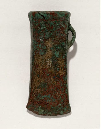
beaker. The beaker was thought to be from the Early Bronze Age.xi
The practice of placing of beakers into graves is thought to have arrived from Scandinavia with the so called 'Beaker People' who it is suggested introduced metal working to Britain 4000 years ago. Beakers were fancy pots for drink or food. Another example from a cist containing a child's grave was found at Thornton at Innerwickxii. It is thought to date from sometime between 2300 and 1800 BC. We can only surmise at the reasons why beakers were placed in graves.
I can't find any evidence for burials in the Nature Reserve area but I suppose that this isn't surprising given the changing nature of this landscape. Once over the Peffer Burn this all changes, as the coast from Aberlady to Longniddry was once a very popular place for burial. It was (NT47NW 1) described in 1792xiii as having:
'…...a great many stone graves, all of them that have been opened containing human bones; particularly in Gosford Links, they are laid almost as thick as in a churchyard; many of them lie nearly south and north.'
The orientation of these graves indicates that they were Pagan due to the fact that Christian graves are usually orientated east west. The author also described the presence of two large tumuli close to the graves.
This abundance of ancient burials continues into the area that is now home to Longniddry golf course and into the private gardens of the residents of Longniddry (NT47NW 6, 7, 10, 13, 14, 39). Excavations at Longniddry have unearthed at least forty different cist burials. The largest of these was in the garden of a house called Four Windsxiv, where a cemetery was found containing at least twenty seven graves. It is likely that the cemetery was in use from the first half of the fifth to the beginning of the eighth century AD. This time span shows a continuity of use into the Christian period and I wonder if it ceased perhaps when they moved to a burial site close to a chapel?

Continuity and conclusion

One of the most captivating elements of this subject is the continuity that can be found at different sites. A site such as the burial mound at Eweford was intermittently used for thousands of years; remaining significant throughout many different burial practices and belief systems. Archaeologists found evidence that when the mound at Eweford was two thousand years old, people started digging pits around the base of the mound and depositing burnt human remains in them. This practice is thought to have continued for about six hundred years. Then later generations covered these pits with stone cairns and into the cairn material they incorporated bone and other artefacts. A later generation then started removing stones from the cairn so that they could create hollows into which they placed human remains. By the time this was happening the mound was an ancient monument which had been the focus point for ceremony for millennia. It was to this site that the people came in 700 BC to start a new phase; they cut into the mound and placed a cist to hold the remains of a funeral pyre. Evidence for similar activity was found at a site close by called Pencraig Hill. This was the site of an ancient mortuary into which the people inserted a cist precisely in relation to the earlier monument, which had been built and burned a millennia earlierxv.
However, the enthusiasm for such burials did not continue into subsequent generations. Burials in the Christian period moved into the churchyard in what was becoming the medieval world. Therefore, we must end our tour through the burial sites of time and place, even though we have just scratched the surface of this fascinating subject.

References


iHistoric Scotland Leaflet: Prehistoric Burials, 2011
iiThe Lands of Ancient Lothian, O. Lelong and G. MacGregor 2008. ISBN13: 978 0903903 417: Page xxi
iiiThe countryside Encyclopaedia. R. Muir. 1988. ISBN. 0-333-43621-0:)Page 118
ivThe Lands of Ancient Lothian, O. Lelong and G. MacGregor 2008. ISBN13: 978 0903903 417: Page 230
vThe Lands of Ancient Lothian, O. Lelong and G. MacGregor 2008. ISBN13: 978 0903903 417: Page 110
viHistoric Scotland Leaflet: Prehistoric Burials, 2011
viiBrothwell and Powers, D R and R (1967) 'A massive cist with multiple Burials of Iron Age date, Lochend, Dunbar, Part II:The Iron Age people of Dunbar', Proc Soc Antiq Scot, vol.98
viii Historic Scotland Leaflet: Prehistoric Burials, 2011
ix SAIR34Two prehistoric short-cists and an early medieval long-cist cemetery with dug graves on Kingston Common, North Berwick, East Lothian by Ian Suddaby: http://www.sair.org.uk/sair34/
xJ T Richardson and J S Richardson Proc Soc Antiq Scot May 12 1902. Page 654- 658
xi http://archaeologydataservice.ac.uk/catalogue/adsdata/arch-352-1/dissemination/pdf/vol_078/78_106_119.pdf
xii http://nms.scran.ac.uk/database/record.php?usi=000-100-035-072-C&scache=2f0361o2ki&searchdb=scra
xiii Roy, N (1792) 'Topographical description of the parish of Aberlady', Archaeol Scot, vol.1 Page 517
xiv Long cist burials at Four Winds, Longniddry,East Lothian: Magnar Dalland, Proc SocAntiq Scot, 122 (1992), 197-206

xv The Lands of Ancient Lothian, O. Lelong and G. MacGregor 2008. ISBN13: 978 0903903 417: Pages 115 - 124

Sunday, 26 January 2014

Luffness: Chapter 5

Early Historic Luffness

If we consider the end of the last ice age as a starting point and the present day as an end point, then by the time we enter the Dark Ages, we are more than 80% through our story. But we are only now getting into the beginnings of a written record and just starting to scratch the surface of history.
The term Dark Ages has gone out of fashion with historians. They now like to use the term Early Historic, to describe the period from AD 400 to 1000. This reflects the fact that although there were few written records for this period, there are some. These are mainly lists of kings and dates of battles, and just like the kings and battles, the lists themselves are often in conflict. The historian Moffati had this to say about the written records of the day:
'Much of the detail of the process of change is unknowable, lost in the memories of long dead bards or written in the forgotten chronicles of ancient monasteries. And what has survived to come down to us is often confused, contradictory, partial, lacking clarity of any sort or just plain mistaken.'.
Therefore it is still the archaeological evidence that sheds the most light on these dimly lit ages.

A Fledgling Nation

At the end of the last chapter we saw that the influence and power of the Romans had left Scotland and as their power waned there were always new invaders who would take advantage of the changing situation.
By the year 600 there were four different peoples that occupied the territory that would later become Scotland. These were the Picts, Scots, Britons, and Angles: and, although there were no definite boundaries; they occupied four separate regions: the Picts, descendants of differing iron age invaders and of late bronze age peoples, in the land from the Forth to the Pentland Firth; the Scots in Dalriada (roughly Argyll); the Britons in Strathclyde, Cumbria and Wales; and the Angles in Bernicia, the northern part of the Anglian kingdom stretching from the Humber to the Firth of Forthii.
To say that these tribes didn't get on together would be an understatement, in fact a lot of the time they were either warring with each other or between different groups within each tribe . Into this mix came the the Vikings in the late eighth century, who came to raid and pillage, to trade and eventually, to settle in Scotland. Orkney and Shetland and the north west of Scotland were dominated by the Vikings for hundreds of yearsiii.
So what was happening in Lothian at this time?
For most of the Early Historic period Lothian was under the influence of the Angles. They used the Humber as a river base to move northwards by sea, establishing themselves in such places as Bamburgh, St. Abb's Head and Dunbar. Then, driving inland they built up a kingdom from the Humber to the Forthiv.
By 638v the Angles had captured the Gododdin stronghold at Din Eidyn -(Edinburgh). The Gododdin were descendants of the Votadini who we last saw trading with the Romans and hoarding silver at Traprain.
Any expansion further nortwards was stopped when they were defeated by the Picts at the battle of Nechtansmere, the modern Dunnichen, near Forfar in 685vi.
If we move on a few hundred years and many battles later to the middle of the ninth century we find Kenneth MacAlpin uniting the peoples to form a fledgling nation called Alba.
However, this new kingdom did not include Lothian which was still part of Northumbria and would continue to be so until Edgar, king of England gave Lothian to Kenneth II (the great grandson of Kenneth MacAlpin) in 973. Although there is some debate about the actual dates and when the final total acquisition of all the land between the Forth and the Tweed occurred, it is agreed that Malcolm II defeated the Northumbrians at the battle of Carham in 1018 to affirm this land as Scottishvii.
So now we have an idea of the historical context we should see what evidence of the Early Historic has been found in the Luffness area.

The Lore of Luffness and Lothian
I suppose the event of greatest significance of this period which is attributed to East Lothian is probably the battle of Athelstaneford and the story of the saltire. This is a good example of the limit of the written record for the period and how myth can fill in the blanks.
Here is the story of the Battle of Athelstaneford taken from the official website of the Sottish Flag Trust:
'The Legend of the Saltire
The St Andrew's Cross or Saltire is Scotland's national flag. Tradition has it that the flag, the white saltire on a blue background, the oldest flag in Europe and the Commonwealth, originated in a battle fought in East Lothian in the Dark Ages.
It is believed that the battle took place in the year 832AD. An army of Picts under Angus mac Fergus, High King of Alba, and aided by a contingent of Scots led by Eochaidh (Kenneth mac Alpin's grandfather) had been on a punitive raid into Lothian (then and for long afterwards Northumbrian territory), and were being pursued by a larger force of Angles and Saxons under one Athelstan.
The Albannach/Scots were caught and stood to face their pursuers in the area of Markle, near East Linton. This is to the north of the modern village of Athelstaneford (which was resited on higher ground in the 18th century), where the Peffer, which flows into the Firth of Forth at Aberlady, forms a wide vale. Being then wholly undrained, the Peffer presented a major obstacle to crossing, and the two armies came together at the ford near the present day farm of Prora (one of the field names there is still the Bloody Lands).
Fearing the outcome of the encounter, King Angus led prayers for deliverance, and was rewarded by seeing a cloud formation of a white saltire (the diagonal cross on which St Andrew had been martyred) against a blue sky. The king vowed that if, with the saint's help, he gained the victory, then Andrew would thereafter be the patron saint of Scotland. The Scots did win, and the Saltire became the flag of Scotland.
When Kenneth mac Alpin, who may have been present with his grandfather at the battle, later united Picts and Scots and named the entity Scotland, Andrew did indeed become the patron saint of the united realm. Kenneth mac Alpin, King of Scots and Picts, Ard-righ Albainn, was laid to rest on Iona in 860AD'viii.
This is of course written under the heading of 'legend'; which is defined as A traditional story sometimes popularly regarded as historical but unauthenticated factix.
This definition describes the content of the story nicely; for it has many dates and names of people who do appear in what little we have of a written record for this time. Although a nice addition to this version is the presence of Kenneth MacAlpin, perhaps hiding behind a tree with a young William Wallace.
But like many legends this tale is considered by many to be fact, even if this is just in the outcome if not in detail; the fact that an outnumbered Scottish army was stirred onto victory by the appearance of a big white cross in the sky; the cross of St. Andrew. This left the English king beaten and St. Andrew as the patron saint of Scotland.
This is a rather patriotic interpretation but what can we find out about the battle if we do a little bit of research There is a lot of confusion about the battle and even the most basic of facts are debatable. Take for example the Scottish schools version moves the battle to almost one hundred years earlier;
'Tradition relates that in AD 735 the king of the Picts, 'Aengus MacFergus', with the support of 'Scots' from Dalriada, won a great battle against King Athelstane of the Northumbrians'x.
The earlier date would at least put the battle in the what is thought to be the lifetime of Angus MacFergus (Oengus MacFergus) c. 690–761xi, but we can not be certain about the identity of the leaders, the exact date, or even the sitexii.
For instance it is easy to confuse the unidentified king called Athelstan who was defeated at the battle with the well known king Athelstan who was the first king of all England and reigned between 925 and 939 AD. It is easy to date kings who leave artifacts such as coins but for Scottish leaders of the early historic period we can not be precise about dates. As we can see there is a large margin of error which could be up to 100 years. Therefore many lifetimes and peoples could overlap even if in fact they were never contemporaries.
We can find a different take on the Battle of Athelstaneford and the legend of the saltire from the National Archives of Scotlandxiii in which the relics of Saint Andrew play a role.
Saint Andrew is the patron saint of Scotland and the first disciple of Christ. He is believed to have been martyred by crucifixion on a diagonal cross in Patras (now part of Greece) in the year 60 AD. (The tradition that his cross was X-shaped goes back no further than the tenth century.xiv). It is thought that his remains were removed to Constantinople about AD 357, but after Constantinople was sacked during the Fourth Crusade in 1204, the relics at Constantinople were taken to the cathedral of St Andrew at Amalfi in Italy. By this time the monastery of Kilrymont (later St Andrews) in Fife claimed to possess three fingers of the saint's right hand, a part of one of his arms, one kneecap, and one of his teeth. St Andrews became a popular pilgrimage destination after miracles were attributed to the saint.
Another explanation for the relics became current by the 12th century. In this version the bishop of Patras (Saint Regulus) removed the relics about AD345, sailed beyond the Mediterranean and was shipwrecked at Kilrymont, where he was welcomed by Angus MacFergus who being grateful to Saint Andrew for his win at the Battle of Athelstaneford endowed the fledgling church with the lands around the bay where the saint had landed. Here we can see that the main action has moved to about four hundred years earlier than the other telling of it.
The Regulus legend was promoted by Scottish kings, nobles and churchmen from the 12th century onwards for political reasons. Scottish independence had come under threat from England since the late 11th century, and the Scottish Church was contesting a claim to primacy by the archbishop of York. Precedence and hierarchy were very important in the middle ages. By promoting the story of Saint Andrew's choice of Scotland in the 4th century, the Scots acquired a top-rank patron saint, a separate identity from England, and a date for the supposed foundation of the Scottish Church, pre-dating the conversion of England and Ireland to Christianity by several centuries.
From this version we can infer that the battle of Athelstaneford must have taken place before 345 for Angus Mac Fergus to be beholden to Saint Andrew. This would mean that there could be a 500 year margin of error in the dating of this battle.
This story illustrates how history can be interpreted and manipulated for political, economical or religious reasons and particularly by people who are searching for a firm foundation on which to build their own, or even a nations identity.
There is one other local connection with St. Andrew and that is that North Berwick owed much of its early importance to its location on the pilgrim route to the shrine of St. Andrew. Pilgrims could travel by boat from North Berwick and this would cut out what must have been a rather arduous route by land. A ferryboat can also be seen on the heraldic arms of North Berwickxv.


Luffness and it's Vikings
Another story from the Early Historic that is often repeated but few authenticated facts are available: the Viking graves of Luffness. In fact the name Luffness is said to have its etymology from these very Vikings. I will let Nigel Tranterxvi tell the story:
'Luffness had a strange genesis. A notorious Viking raider, Anlaf the Dane, had captured this Pictish fort four centuries before ( the book is set in 1214), and two of his party had fought each other, for some reason unknown, both being killed, one called Lofda. These had been buried beneath one fortlet flooring, and their their remains were still buried beneath the presentkee's stones, marked by little crosses- which they scarcely deserved, both being pagans. So Lofda's Ness or headland had become the name Luffness.'.
A small detail that can be added to this tale isxvii:
'One of the graves lays a supposedly high ranked commander known as Lofda to Anlaf the Dane in his army, to whom the castles name Luffness is derived from. When his grave was dug up the skeleton remains uncovered that Lofda himself may have been a huge man being seven feet tall.'.
This is the usual story that is told about the Viking origin of Luffness with embellishments or not. However, this isn't to say that there is no truth in the story just that I can't find a reliable source for its origin. The story is told without reference to any documents (scarce during this time period) or archaeological evidence. The RCAHMS has a record (NT48SE 1.01) for stone slab graves found at Luffness :
'Two stone slabs 3ft 8 ins long, 1ft 9 ins broad and 5 ins thick lie in the kitchen garden of Luffness House. They are presumed to be covers of cists, of which three were found beneath the floor of the entrance hall of the House.
RCAHMS 1924, visited 1913'.

These finds were not dated and unfortunately the stone slabs could not be located on more recent visits in 1962 and 1975. However they do sound very similar to slabs that are described in another book by Nigel Tranterxviii in which he states:
'Under the floor of the vaulted basement chamber now the entrance vestibule, are the graves of two Viking raiders....'.

Were they really Viking graves and if so what became of them?
In fact the RCAHMS has the details of 324 Viking related sites or finds in Scotland but only one (NT58NE 2.01) of these is in East Lothian. Unfortunately it is not our graves but a Viking comb (illustration 1)xix. made from a piece of antler and found in Kirk Ports in North Berwick when they were doing the road widening in 1994xx.


Illustration 1: This antler comb was found at North Berwick in East Lothian. It is a Scandinavian type, either brought with the first wave of Viking raiders or settlers, or perhaps imported by traders in the 9th or 10th century. The comb consists of plates of antler cut into teeth (now broken off), riveted together between two connecting plates on top. The corroding metal rivets are visible. The plate was decorated with an incised geometric design. Combs of this type were widely distributed in northern Europe during the Viking period, and their places of production and sources of antler are not certain. Some have elaborate decoration and cases.


Perhaps Nigel Tranter is the source of the Luffness Viking story? He spent most of his life writing about and probably studying Scottish history, he also lived at Luffness and knew the Hope family who own Luffness castle, so he could have had access to information that I'm not aware of.
Let us leave the this grey area behind and move onto the more tangible finds of the period.


The Early Historic Archaeological Evidence
The finds are shown in Table one:
RCAHMS SITE NUMBER LOCATION OF FIND SITE TYPE
NT48SE 185 Luffness  MOUNT, SWORD (COPPER) 
NT48SE 146 Aberlady  PIN (COPPER) 
NT48SE 31 Gullane Point  DAGGER (BRONZE)
NT48SE 12 Brand's Well, Gala Law HOLY WELL (POSSIBLE) 
NT48SE 17 Luffness  FOOD VESSEL 
Table 1: The Early Historic Finds

The finds from the RCAHMS that are shown in the table have all been attributed to the Early Historic, but there isn't a lot to shout about. I suppose an object made of iron could well have corroded away to leave little trace. Brands Well (NT48SE 12) on Gala Law does show that this site has had a continual significance through out the different ages. I do not know who the eponymous Brand is but it is noted that it is the only spring of water on Gala Law, is possibly a holy well endowed at Gullane by David I. Note that David I lived from 1084-1153 which takes it into the medieval.


The National Museum of Scotland does have a few finds from the Early Historic which were found at Kilspindie Castle, Glebe Field, in Aberlady:
'The castle is of late sixteenth century date but metal detecting over several years has recovered a rich assemblage of artefacts, the quantity and concentration of which suggest that settlement in this field dates back to the Northumbrian period and possibly earlier. Finds from the Northumbrian period include a substantial assemblage of coins and metalwork far in excess of what might be expected from a series of stray finds.'.xxi
A geophysics survey showed what could be evidence of:
'The remains of two timber halls (one overlying the other at right angles) of possible Anglian or earlier date; a series of ditch-defined enclosures of probable Anglian morphology; a roughly pear-shaped enclosure (within which there appears to be a double palisade line); and annular features which appear to be the footings of ring-groove houses.'xxii.
The site is a scheduled monument and is of national importance:
'..because of its potential to add to our understanding of settlement in southern Scotland during the period of Northumbrian influence. The possibility of tracing the continuous development of settlement through the Northumbrian and medieval periods, without the overburden of subsequent buildings, makes this a site of considerable rarity and importance.'xxiii.
It does make you wonder what other remains of national importance are slumbering under the layers of soil and sand which are yet to be revealed.
With that we conclude our brief overview of the the Early Historic. We leave Luffness as part of a fledgling nation and we shall see in the next chapter what role Luffness played in the next time period: the medieval.

References
i Moffat A., Before Scotland: The story of Scotland Before History, ISBN. 0500005133X: 2005, page 285
ii Scotland from the earliest times to 1603, W. Dickinson, A. Duncan , 1977, ISBN 0-19-822453-2; Page 23
iii http://www.educationscotland.gov.uk/scotlandshistory/britonsgaelsvikings/vikings/index.asp
iv Scotland from the earliest times to 1603, W. Dickinson, A. Duncan , 1977, ISBN 0-19-822453-2; Page 26
vi Scotland from the earliest times to 1603, W. Dickinson, A. Duncan , 1977, ISBN 0-19-822453-2; Page 27
vii Scotland from the earliest times to 1603, W. Dickinson, A. Duncan , 1977, ISBN 0-19-822453-2; Page 27
ix The Concise Oxford Dictionary of Current English. Eighth Edition, BCA: 1990
xi The Oxford Companion to British History (1 rev ed.), eISBN: 9780199567638
xii A Portrait of The Lothians, Nigel Tranter, ISBN 0-7091-7467-5; 1979.
xiii http://www.nas.gov.uk/about/051124.asp
xiv The Oxford Dictionary of World Religions ISBN 0-19-866242-4: 1997
xv North Berwick, East Lothian: its archaeology revisited, D. Hall and D. Bowler, Proceedings of the Society of Antiquaries Scotland, 127 (1997), 659-675
xvi Sword of State, Nigel Tranter, ISBN 9780340696736: 1999
xvii http://castlesinscotland.net/luffness-castle/
xviii Tales and Traditions of Scottish castle, Nigel Tranter: ISBN-10: 1906476748: 2012
xix http://nms.scran.ac.uk/database/record.php?usi=000-000-099-674-C&scache=3wurpl7hmr&searchdb=scran&PHPSESSID=kq57s29vag9i29smf4800vf310
xx http://canmore.rcahms.gov.uk/en/site/88927/details/north+berwick+st+andrew+s+churchyard/
xxi http://data.historic-scotland.gov.uk/pls/htmldb/f?p=2300:35:1365436626500669::NO::P35_SELECTED_MONUMENT:5997
xxii http://canmore.rcahms.gov.uk/en/site/55053/details/kilspindie+castle/

xxiii http://data.historic-scotland.gov.uk/pls/htmldb/f?p=2300:35:1365436626500669::NO::P35_SELECTED_MONUMENT:5997

Saturday, 25 January 2014

Luffness: Chapter 3

The Bronze Age of Luffness


The start of the Bronze Age in Scotland can be dated to the late third millennium BC when the new technology was slowly introduced from Europe and continues until about the eighth century BC; this is when iron objects begin to be introducedi.
However, like most changes in culture and technology there is an overlap between the old Neolithic lifestyle and the brave new world of bronze. The period of prehistory when both stone and bronze implements were used is called the Chalcolithicii. This was a time when the prized objects that were fashioned in stone were now beginning to be cast in Bronze. We can see from the axehead find at Luffness (Table 1) that there was some continuity in the objects that the people of the new age valued.


RCAHMS SITE NUMBER LOCATION OF FIND SITE TYPE
NT48SE 9 Gullane  SOCKETED AXEHEAD (BRONZE)(BRONZE AGE)
NT48SE 24 Gala Law  JEWELLERY (GOLD)(BRONZE AGE)
NT48SE 23 Gala Law  FOOD VESSEL (BRONZE AGE) 


Table 1: The Bronze Age finds


The miniature socketed bronze axehead (NT48SE 9) (illustration 1)iiiis dated to the Bronze Age on the RCAHMS websiteiv and described thus:
'A late Bronze Age socketed and looped axe, almost 2 1/2" long, and covered with a fine green patina was found in 1923, about 15' N of a probable Bronze Age burial in one of the sandy ravines E of Gullane (NT 48 82). It is now in the National Museum of Antiquities of Scotland [NMAS] (Accession no: DE 126).'.
However on the National Museum of Scotland (NMS) website it is described as dating from the Iron Age.

Illustration 1: These miniature axeheads, one of stone and the other two of bronze, were found at Hawick in Roxburghshire, at Blairbury in Wigtownshire and at Muirfield at Gullane in East Lothian. They were probably used as amulets. Miniature polished stone axe head, from Hawick, Roxburghshire. Axeheads were symbols of power and prestige for a long period, probably with religious significance as well. They were sometimes used as offerings to the gods. Miniature examples were probably amulets, and remained popular for thousands of years. Dates of axeheads, left to right: between 4000 and 1500 BC, between 950 and 750 BC, between 200 BC and 100 AD.


What ever the date, this does show us that the axehead as a symbol or as a tool continued through the Bronze Age. A couple of Bronze Age axeheads were found on North Berwick Law and one is shown here (illustration 2)v.

Illustration 2: This bronze axehead was found at North Berwick Law in East Lothian. It dates from between 1150 and 950 BC. The long narrow socketed axehead has an oblong mouth encircled by a slight moulding. A wooden handle would have fitted into the axehead's socket. A thong could also have attached the axehead to the socket through the loop. Socketed axeheads appear to have been invented on the Continent. They are part of a range of socketed tools and swords made by smiths requiring more complex casting techniques.


What does the new material and the objects tell us about the people and society of the Bronze Age?

Bronze is an alloy of copper and tin which are not usually found together but require the ingenuity of man to extract and combine them. To produce the items that have been found in the Luffness area would require often distant sources and technology, which dictated that Scotland had to become part of an international network facilitating the distribution of metal and other materialsvi.
Therefore, we must have had a society that not only had miners and metullargists but also a hierarchy who could purchase goods such as the gold jewellery (NT48SE 24).
What is also needed for the people of the coastal plain of eastern Scotland is a form of commerce allowing them to purchase the items made by the bronze 'industry'vii. This was a period of dramatic social, economic, and cultural change, characterised by changes in social stratification, rich regional diversity and an increase in inter-regional, indeed international, interaction, and development of the landscape.
It has been suggested that the Bronze Age can be considered as a tunnel into which the Neolithic cattle train disappears to emerge as two millennia later as an iron horse. So, let us now exit the tunnel and see the light of the Iron Age.
i Scotland After the Ice Age: An Environment, Archaeology and History 8000 BC - AD 1000:
Kevin J. Edwards, Ian B. M.Ralston.
Edinburgh University Press, 2003; Page 8
iiThe Consise Oxford Dictionary
iii http://nms.scran.ac.uk/database/record.php?usi=000-100-032-872-C&scache=4a7ul64fo1&searchdb=scran&PHPSESSID=hnlkvlfb5sflvoga7p7bu2iga6
iv http://canmore.rcahms.gov.uk/en/site/55084/details/gullane/
v http://nms.scran.ac.uk/database/record.php?usi=000-100-104-703-C&scache=5byzr64fod&searchdb=scran&PHPSESSID=hnlkvlfb5sflvoga7p7bu2iga6
vi http://tinyurl.com/clxgf5s

vii The New Penguin History of Scotland: From the Earliest Times to the Present Day
edited by: R. A. Houston, W. W. J. Knox
London, Allen Lane, The Penguin Press in association with the National Museums of Scotland,  2001, ISBN: 9780713991871 Page 6.